North East Region
Your Local Guide to the North East Region of Nigeria

Note: In recent times the North East of Nigeria as been plagued by terrorism attacks. You are advised to avoid many areas in this region, see links for more information.
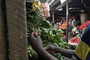
The north-eastern part of Nigeria comprises of six states, with this region mostly known for the production of crops and livestock which contribute greatly to the economy of the country. The region is densely populated as compared to the southern region of the country. The major tribes are Hausa and Fulani which are largely Muslim.
Adamawa State - Land of Beauty

This state is one of those formed in 1991 from part of Gongola State and the capital is Yola. The state occupies about 36,917 square kilometres â making it one of the largest states in the country. It shares the north-west, west and south-west border with Borno, Gombe and Taraba states respectively. The eastern border of the state also serves as a national border with Cameroon. Adamawa State has mountainous land with large river valleys crossing it. This includes River Benue and River Gongola, with the Adamawa and Mandara mountains and the valleys of Cameroon forming part of the undulating landscape. In Adamawa State, there are abundant deposits of natural ores such as iron, lead, limestone, zinc etc.
The major occupation of the people in this state is farming as this is reflected in their two prominent vegetational zones- tile Sub-Sudan and Northern Guinea Savannah Zones. Their cash crops are usually cotton and groundnuts while food crops include cassava, yam, guinea corn, maize, millet and rice. The village communities living on the banks of the rivers are mostly fishermen while the Fulanis engage in cattle rearing.
Points of interest and things to do in Adamawa State include:
Sukur Cultural Landscape, Mandara Mountains, Koma Hills, Lamurde Hot Spring, Sukur Touristsâ Haven. The state has a good network of roads connecting all parts of the country.
Bauchi State â Home of Peace and Hospitality

The capital city of this state is also known as Bauchi, and until 1976, the state was a province in the then North-Eastern State. Bauchi State occupies 49,119 square kilometres of Nigeriaâs total land mass. It is bordered to the north by Kano and Jigawa State, to the south by Taraba and Plateau State, Kaduna to the west and Gombe and Yobe to the east. Bauchi State has huge fertile soil which creates occupation for them in cattle rearing and cultivation of other agricultural products such as guinea corn, millet, rice, groundnut and maize.
There are 55 major tribes that form the tribal groups in the state, including Badawa, Bolewa, Butawa, Faâawa, Fulani, Gerawa, Hausa, Jarawa, Kanuri, Karekare, Savawa, Wariawa and Zulawa. With a high level of ethnic interaction especially in marriage and economic existence, there exists cultural similarities in the peopleâs language, occupation, festivals and dressing. The people of Bauchi State are recognised for their traditional boxing and wrestling dexterity. The traditional wrestling is known as Kokowa while the traditional boxing is called Dambe.
Bauchi state is also known for its arts and crafts which are beautiful embroidered caps and gowns (known as babbanriga), fibre craft, and decorated calabashes. They also engage in Mat weaving and leather works include the production of sitting pouffes, bags, footwears, footballs.
Bauchi state has two distinguishing vegetation zones which are the Sudan Savannah and the Sahel Savannah.
Points of interest and things to do in Bauchi State include:
Yankari Game Reserve, Wikki Warm Spring, Iron Smelting, Marshall Caves, Tunga Dutse, Sumu Wildlife, Kalban Hill, First Mining Beacon, Babban Gwani at Kafin Madaki, and Lame/Burra Game Reserve.
Borno State - Home of Peace

Borno State was formed from the then North-Eastern State in 1976 with Maiduguri as its capital. The state is mainly dominated by the Kanuri and Babur with few Shuwa Arab ethnic groups. Borno occupies about 70,898km2, sharing borders with Niger Republic to the north, Cameroon to the east, Chad to the north-east, Adamawa State down south, Gombe State to the east and Yobe State to the north-west.
The state is an example of enduring traditional political institutions in some parts of Africa, with the Emirs of the former Kanem-Bornu Empire contributing majorly in the politics of the area for about 1000 years.
Gombe State - Jewel of the Savannah

Gombe State was created out of Bauchi State on 1st October, 1996 by the then General Abacha administration, with its capital city also called Gombe. The state is bordered by Borno and Yobe State to the north and east respectively, Taraba and Adamawa State to the south and Bauchi State to the west. It covers an area of about 20,265km2 with most of the people coming from the Fulani tribe.The state is endowed with natural resources such as uranium, gypsum and limestone. There are 21 languages spoken here which include Fulfulde, Hausa, Tangala and Waja.
The state is found right within the expansive savannah region and has 11 Local Government Areas. This state comprises of several tribal or ethnic groups among which are the Hausa, Tangale, Terawa, Waja, Kumo, Fulani, Bolewa, Jukun, Tula, Cham, Lunguda, Dadiya, Banbuka etc. Hausa is the common language of the people.
Farming is the chief occupation of the people of Gombe State and crops usually produced include cassava, rice, maize, yam, soya beans, guinea corn, beans, asha and millet. The state is endowed with mineral resources like columbite, coal and aquamarine.
Their important cities and towns include Dukku, Billiri, Bajoga and Kaltungo while the tourist centres include Emirs Palace, Gombe, Tangale Hill, Tangle Peak, Kilang Hill, Popandi Village, Tula Battlefield, Tula, Tomb of Bubayero Gombe Abba, Bormi Battle site, Bormi.
Taraba State - Natureâs Gift of the Nation

Taraba, with the capital city of Jalingo, was created from the former Gongola State in 1991 by the then military head of state, General Ibrahim Babangida. The state is named after the major Taraba River which cuts across the southern part of the state. Bordered to the west by Plateau and Benue States, Republic of Cameroon to the east and Gombe State to the north, Taraba occupies about 54,473 square kilometres of Nigeria. The state lies mostly within the middle of Nigeria and is be made up of undulating landscape dotted with a few mountainous landforms. The southern part of the state has a vegetation of low forest while the northern part maintains an undulating grassland. River Benue, Donga, Taraba and Ibi are the main rivers rising from the Cameroon mountains and all are linked to the River Niger.
Taraba is a highly varied, multi ethnic state with close to eighty indigenous ethnic groups speaking different languages. Some of the major ethnic groups include Fulani, Mumuye, Jukun, Jango, Chamba, Mambilla and Kuteb. The major occupation of the people include primary activities such as farming, fishing, pottery, cloth weaving, dyeing, mat making, woodcarving, embroidery and blacksmithing. There are a multiplicity of cultural festivals typically performed to mark harvest, marriages, initiation into manhood or womanhood, installation of rulers, and other ceremonies and entertainments. The people of Taraba State largely make their living through farming, and produce crops such as coffee, tea, cotton and groundnuts, maize, rice, millet, cassava and yam. They also rear cattle, sheep and goats, with other livestock production activities like poultry, rabbit breeding and pig farming, thus making the state one of the major livestock production areas in the country.
Important cities and towns in Taraba State include Jalingo, Wukari, Zing, Sardauna, Bali, Yono, Kurmi, Ibi, Takun and Gashaka.
Points of interest and things to do in Taraba State include:
Mambilla Plateau (which comprises a mountain chain of Adamawa, Obudu,Shebshi and Alantika). Gashaka-Gumti Game Reserve (which is Nigeriaâs largest national park, covering an area of 6600 square kilometres). Ngel-Nyaki Forest Reserve (which is about 60km west of Gashaka Gumti National Park contains chimpanzees, buffalos, monkeys, antelopes and eighty-six species of birds). Donga River Basin Forest (this is one of the major sites for bird watching in Nigeria with a record of over 190 species of birds recorded).
Yobe State - The Young Shall Grow

Yobe State, which is mainly agricultural and covers an area of about 45,502km2, was created in 1991 with Damaturu as its capital. The state shares borders with Borno State to the east, Gombe State to the south, Bauchi and Jigawa States to the east and Niger Republic to the North.
The people are mainly known to be farmers, fishermen or livestock rearers. The state also boasts of one of the largest cattle markets in West Africa and has deposits of natural resources like gypsum, kaolin and quartz.
Yobe is a mainly agricultural state was carved out of the old Borno State on 27th August, 1991 by the military government of General Ibrahim Babangida. It is divided into 17 Local Government Areas. With a projected population of about 2.5 Million, Yobe Stateâs ethnic configuration has a rich and diverse cultural heritage. There are 5 major ethnic groups in the state- the Kanuri, Fulani, Karekare, Bade and Hausa.
The people of Yobe are prominent for their Durbar â rich culture and traditions arising from their historical association with North Africa and Eastern Arabian.
Some of their key festivals include:
Kamti Festival
This festival is celebrated on clan and lineage basis starting with Janga clan around September and later in December the rest of the clans take their turn.
Barakau Festival
The festival serves as a time to offer sacrifices and gratitude to God for the bumper harvest and an opportunity for young men and women to prove their prowess through traditional wrestling dance and other skilful arts.
Bade Fishing & Cultural Festival
The is a prominent feature of the state cultural heritage that comes up annually near the historical town of Gogaram in Jakusko LGA at Al-Kamaram river site. Visitors to this festival are entertained through cultural acrobatics and water displays as well as traditional techniques of fishing.
Other important cities and towns include Damaturu, Gashua, Giedam, Nguru, and Potiskum:
Points of interest and things to do in Yobe State include:
Dufuna Canoe (Africaâs oldest known boat), Bula Tura Oases, Nguru, Dokshi Spring Water, Dagona Birds Sanctuary, Birnin Ngazargamu, Tulo-Tulowa (also known as âThe Desert Land of Hopeâ), Goya Valley (probably the deepest Gorge Valley in Nigeria).